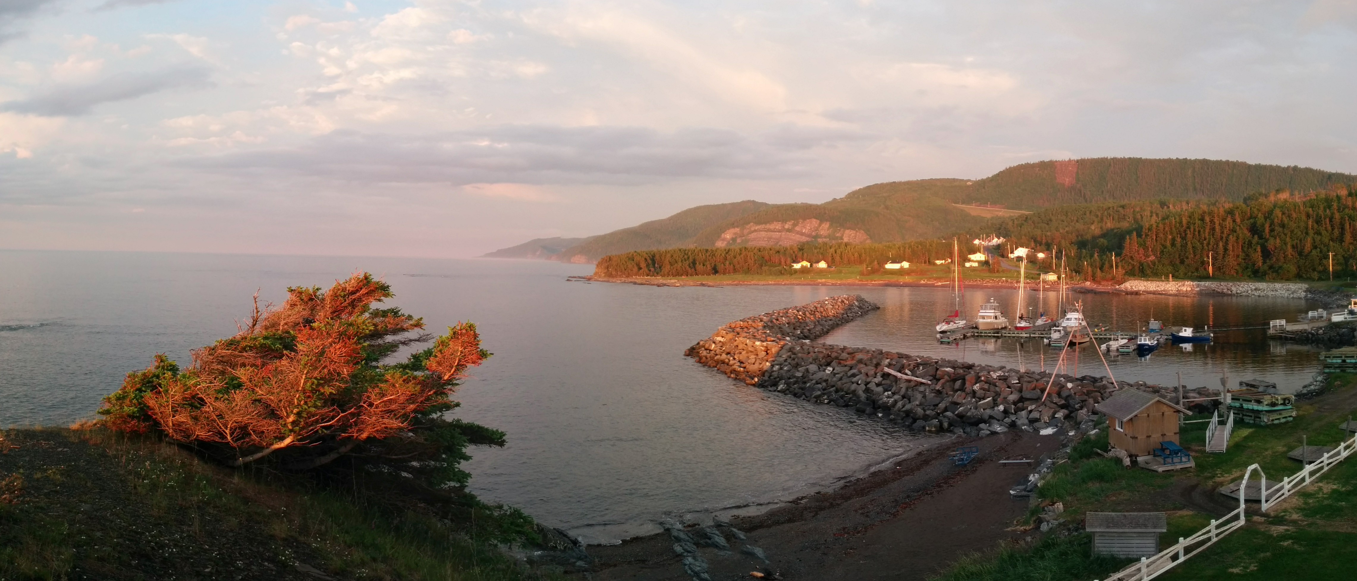
Wednesday, 6/29/16, In Port
All the guide books say to avoid being out on this part of the Gulf of St. Lawrence in an Easterly wind. Today’s forecast was for Easterly winds with gusts up to 25 knots. For a change, the forecast seems to be correct. One other boat that was here last night headed out for another port just 17 miles away. But this port has good docks, electric hookups, and (most of the time) WiFi. We’re staying.
A couple of times I’ve posted pictures of the screen of our main GPS chartplotter, and thought maybe this was a good time to explain the navigation equipment on Cygnus. First and foremost, we have a full set of up-to-date paper charts of the areas we plan to cover, along with basic navigation tools like compasses, dividers, parallel rulers, pencils and lots of erasers.
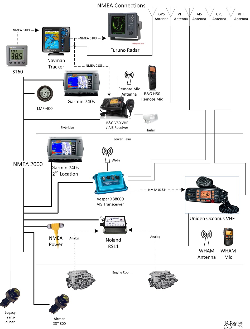
All of this is backed up with a variety of electonic tools. The boat came with a full electronics suite installed in 2000, including a Furuno CRT radar and Navman GPS chartplotter. These old workhorses still do the job, and are used regularly. The radar can be manually tuned when we want to highlight the shoreline, other boats, or rain sqalls. The Navman chartplotter offers a second chart display we can zoom out for a “big picture” view, and has a handy trip odometer feature that’s right on the main display all the time. These communicate with each other, and an older depth sounder and VHF radio, using a protocol called NMEA 0183.
A newer set of electronics communicate over a newer technology, NMEA 2000. These include our main Garmin GPS chartplotter with built-in radar overlay, BMG VHF marine radio, Noland engine data computer, Vesper AIS transponder, Airmar depth sounder, a Lowrance LMF-400 dashboard multi-function display and, of course, Otto the Simrad Autopilot. It looks far more complicated than it is:
It’s great having all this data available, in so many different formats. With the exception of docking, undocking and close maneuvering, we typically don’t touch the wheel. We either choose a pre-programmed route, or pick a spot on the chart we want to go to, then hit a button and Otto steers us there. This frees us up to keep a lookout for hazards in front of us, as well as monitor all the other data flowing to the helm station. Here’s the Garmin display I posted earlier, at our Northernmost point:
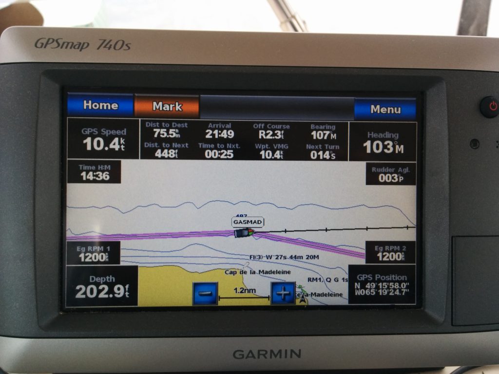
Starting at the top row, our speed was 10.4 knots (we were going about 7-8 knots through the water, so we had about a 2-knot assist from the current.) We were on a pre-planned route, shown by the wide magenta line on the chart. The final destination for this route (the tip of the Gaspe peninsula) was 75.5 miles away. At the current speed we’d arrive there at 21:49 (9:49 PM). We were off course by 2.3 feet with a bearing of 107 degrees magnetic to our next waypoint. Our current compass course was 103 degrees magnetic. On the next line, this photo was snapped 448 feet before our next waypoint (GASMAD, the Northmost point of the trip), which we’d reach in 25 seconds. Our velocity made good to this point was a consistent 10.4 knots. Our next turn would be 14 degrees to starboard. The time was 14:36 (2:36 PM) and the current rudder position was 3 degrees to port. Both engines were running at 1200 RPM, the depth was 202.9 feet and the latitude and logitude were shown at the lower right.
This is only part of what we can display. There are “dashboard” gauges for all the engine parameters, environmental readings, lists of nearby vessels transmitting an AIS signal, route and waypoint lists, radar overlay options, and different types of charts, including a perspective view and “fish eye” view. The chart can be zoomed in and out for more or less detail.
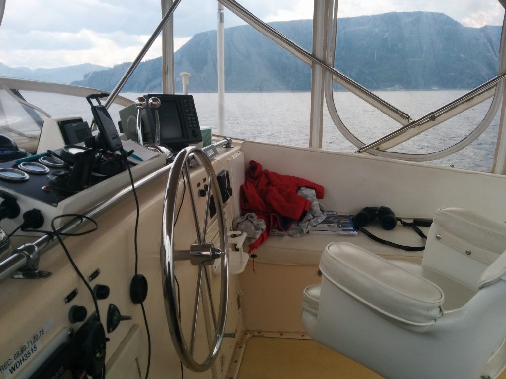
And here’s a picture of Otto at the helm:
We’re also running a Go-Pro knock-off camera on the bow that takes a snapshot every 30 seconds. Theoretically, we can stich these into a time-lapse video of the trip. Most of which would be pretty boring, but I’m sure with good post-production we could make some interesting clips. I haven’t found a good program to do this yet, however. The Go-Pro Studio software doesn’t seem to like my laptop, and Microsoft Movie Maker dies with an out-of-memory error every time it tries to stitch together the frames. Suggestions welcome.
We have two Down East Loop guide books, one of which is pretty dated, along with ActiveCaptain data, which contains crowd-sourced reviews of all the ports, marinas and achorages. The ActiveCaptain data is loaded onto one of the two cell phone apps we use which support Canadian charts, and another that covers only the US. The phone also has a compass app, and can tap into the NMEA 2000 network using a WiFi connection to the Vesper AIS transceiver to display other vessels in the area. In a pinch, we could navigate using just the phone.
The problem with both the printed and electronic guides is that there just aren’t many people who travel this coast. We’ve only run into a few other boaters traveling the same way, all sail boats. Bear Keeper is travelling from Pennsylvania to Maine, with plans to continue on to the Bahamas in the fall. Nord Sud and Blanchons.qc.ca are sail traning boats, one traveling to Gaspe and the other turning back toward Rimouski tonight. Caribou is crewed by a young Quebec couple on vacation, also to Gaspe town. Great folks, but no other loopers.
The American Great Loop Cruisers Association has a lot of members, many of whom we saw going up the Hudson toward the Erie Canal, flying their AGLCA burgees. There are three burgees, depending on whether the boat has not yet done the Great Loop, or only once, or multiple times.
![]()
Down East Loopers don’t have a burgee. We need one. I’m announcing the start of a burgee design contest. Send in your best designs!
Great write up on the navigation! I have one question… not concerning navigation. How does the dog go to the bathroom??
Great commentaries and pictures. Very interesting.
Thank you, Tom’s a good story teller and photographer.
The dog has learned to be let “out” on deck, where anything he does can be washed away. When we’re in port, however, he expects to be taken on “proper” walks two or three times a day. He doesn’t understand the purpose of these walks. He thinks it’s so that he can sniff every fence post, light post, hole in the ground and patch of grass along the way, depositing his own “calling cards” wherever his dog instincts tell him they’re supposed to be deposited.
How do you send in your designs for the burgee?
E-mail them to me. I’ll post them on this site.