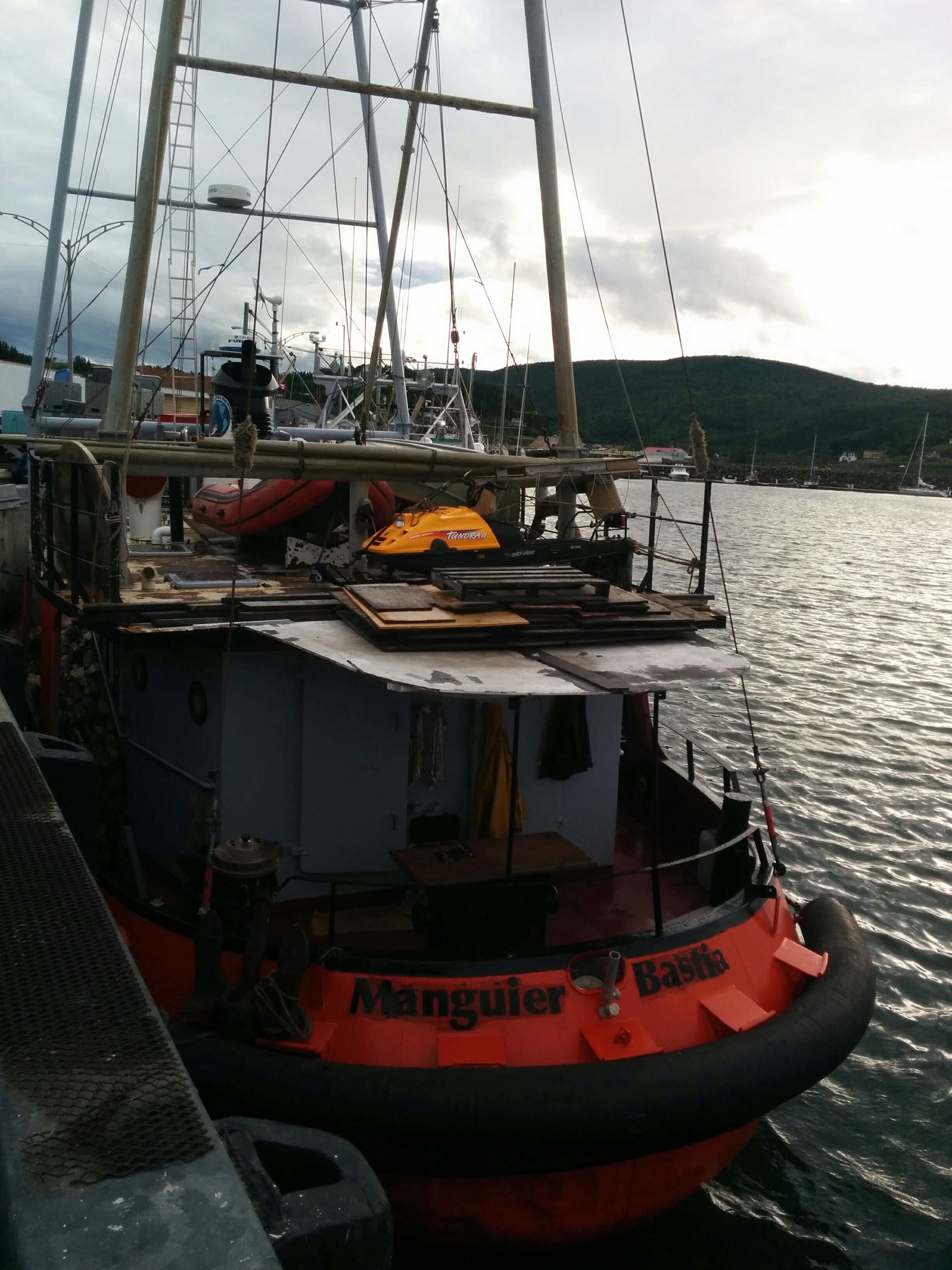
Zen and the Art of Diesel Maintenance

Sunday, July 10th

As promised, Paul the mechanic showed up at 9 AM to pick up the injector pump. I’d already taken it out yesterday, with only minor blood loss and a few choice words.

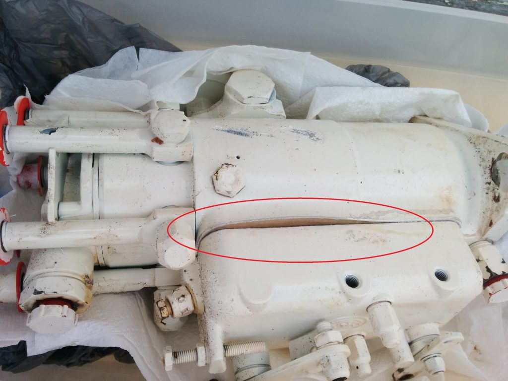
By quarter to ten, he was back with the pump, new gasket in place. While I have the tools, and almost the ability, to do some maintenance jobs, taking apart a high-pressure fuel injector pump is not something it would be wise for me to attempt. They’re full of small and intricate parts, all of which need to work properly together or bad things happen.

After two more hours of blood-letting, I managed to get everything back together and got all the air out of the fuel system. Without going into the boring details, suffice it to say it’s not a fun job.

The engine fired right up, and ran well. I couldn’t see any leaks. So we hit the “stop” switch to shut it down.

First, you have to understand that a diesel engine doesn’t have spark plugs. Diesels run just fine without any electrical power at all. There’s no ignition to shut off. You have to stop them by cutting off the fuel supply.

The fuel supply shutoff is an electrically actuated lever on the injector pump. We’d cycled it a couple of times before starting the engine to verify it was connected correctly. It was.

But it didn’t shut off the fuel supply when it was energized. The engine continued to run as if nothing had happened. The only other option was to shut off the fuel supply at the valve before the primary filter, which still leaves a lot of fuel in the system for it to run through. I tried another old trick, blocking the air supply, but even that took a while, because the powerful suction of a high-compression engine still pulls in some air.

The connections worked fine; the shutoff lever was moving fully when we hit the switch. But it’s connected to the injector internals through the cover that had been removed and replaced to change out the gasket. I can only assume something didn’t get re-connected internally. I know what it means to make assumptions, still, that does seem the most likely possibility. My only option was to try to reach Paul, who had said to call him if there were any problems.

A quick call to Paul went unanswered. That’s not surprising; cell coverage around here is spotty at best, so I left a message.

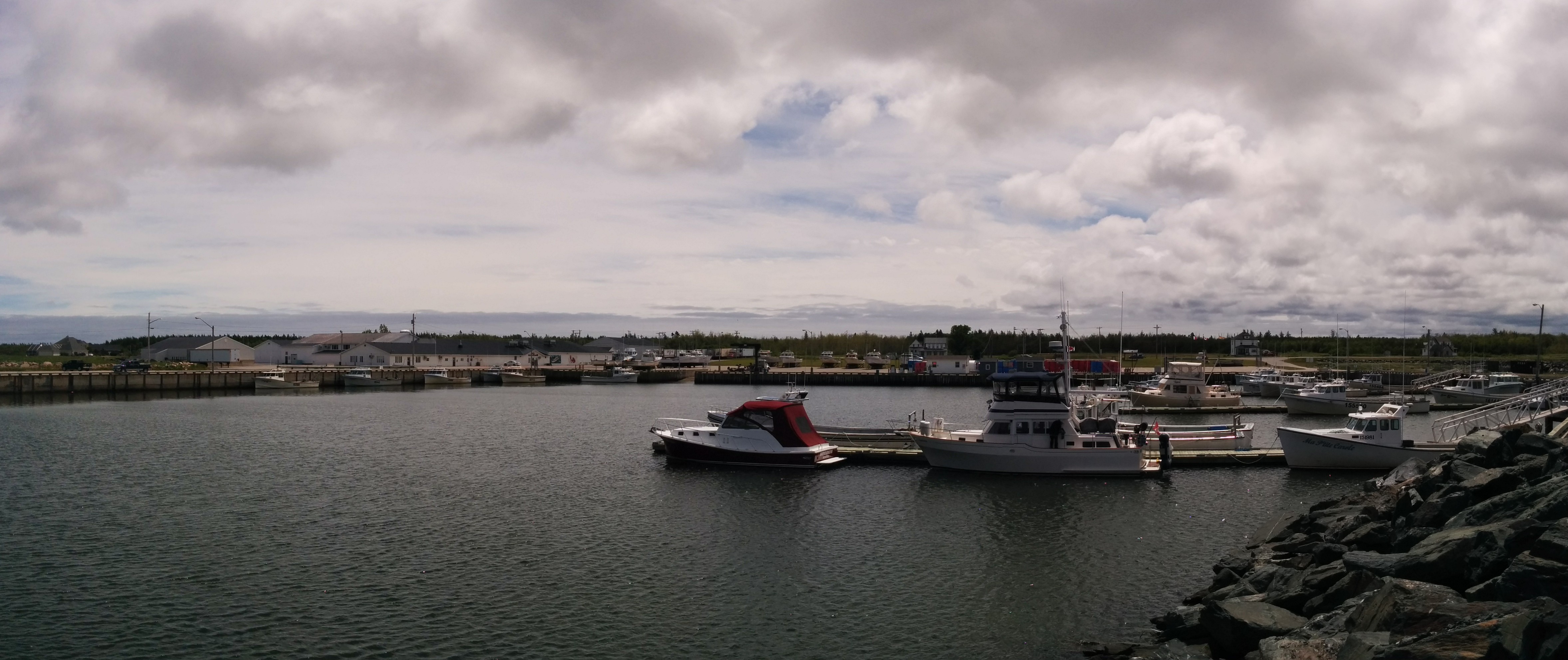
About this time, one of the locals who we’d met earlier arrived with his wife to offer us a ride to the Co-Op market about 10 kilometers away, in Baie-Sainte-Anne. When they heard our predicament, they immediately started working on finding Paul. We drove by his house; not home. We drove by his girlfriends house. Nope. We saw a car that looked like his at the convenience store, but it wasn’t him. We stopped at his parent’s house and asked his father. Nope. We swung by his brother’s place. Not there either. Our hostess stopped by her sister’s camper to ask her, sometimes he’s in that campground. Nobody there had seen him today. We drove by a couple of other known hang-outs without success.

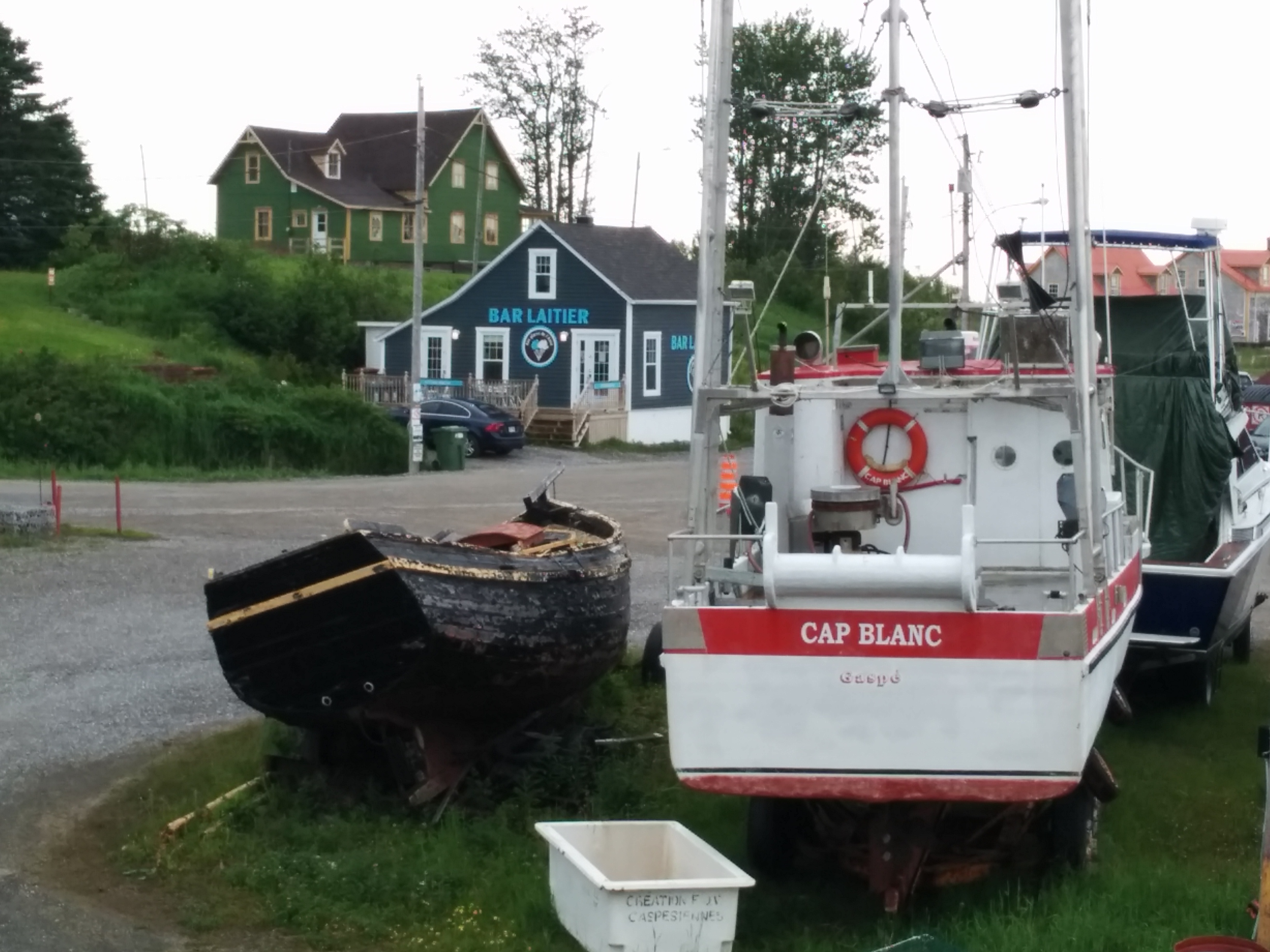
Along the way, we got the grand tour of this region. The population is about 2,700. Beside fishing, another big industry is peat moss, which is exported to the US. The region has all the essentials; school, firehouse, municipal offices, police station (but don’t expect to see a policeman – not sure why not), arena (presumably hockey), home improvement/lumber store, and quite a bit more. The houses of all the relatives of our tour guides were pointed out. The nicest homes in the area belong to the owners of the fish processing plant and their children.

The towns here are French-speaking, while neighboring towns are populated by English speakers. But everyone is bi-lingual, as are all the signs.

With the whole town now alerted, I’m sure Paul will be showing up at some point to help us sort out the issue with the shutoff.

Good Weather, But…

Saturday, June 9th

Just before sunset we were treated to a textbook display of Cirrus uncinus, or “mare’s tails” clouds. These often signal the approach of a warm front, however, winds continued to diminish overnight and the sky was ablaze with stars.
Cirrus uncinus clounds

Saturday brought a postcard sunrise and calm winds.
Saturday Sunrise

The day looked perfect for covering the long stretch of open water to our first-choice port for the night.

It was not to be. Underway, I do engine checks at least hourly. This includes taking in the sounds, sights and smells of the engine room, taking some temperature measurements, checking the bilges and the numbers on some gauges. But most of all, being in the engine room allows me to notice anything unexpected.

One thing that came up recently was a very slow fuel leak from the port injector pump. This part had been recently rebuilt, but over the course of a couple of hours running the engine, there would be a small drop of fuel on the bottom of the case. Not an emergency, but something I looked at very closely each hour for the past few days.

Today, one hour out of our anchorage, I didn’t need to look closely. It was clear that it had gone from a drop to a steady flow of fuel into the pan below the engine. In that hour, over five gallons of fuel had leaked into the pan. Many times I’ve appreciated having these engine pans. This time had to be the best save yet. That much fuel in the bilge would have been a much bigger problem!

We quickly shut down the port engine and diverted to our second-choice destination, Escuminac Harbor, just 14 miles from our anchorage in Miramichi Bay. This is a good sized fishing port; almost exclusively lobster boats. Fortunately for us, the lobster season around here closed at the end of June, and won’t start again in another zone until fall, so we were able to find a spot on the floating docks. Most fishing harbors only have a steel or concrete wall to tie to, so the floats were greatly appreciated.
Escuminac Harbor

A local boater passing by in a small outboard directed us to an empty spot on one of the docks, and another local came over to help us with our lines. Within 15 minutes of tying up, we’d already gotten the names of two area diesel mechanics, and met one more. We’d also gotten two offers for rides to town if we need anything, and were lent an extension cord in case we needed it to reach the power outlet up on shore.

The mechanic who was already here working on another boat came by when he was done, and quickly diagnosed the problem. The leak was from a gasket that had been blown out of place.
Injector Pump with Blown Gasket

The mechanic said he’d be back this way tomorrow or Monday, and if I removed the pump, he’d pick it up, bring it back to his shop, fix it, and bring it back here. He wasn’t sure if he had the replacement gasket in stock or if he’d have to order it, but either way he sounded confident it would be a reasonably quick turnaround. My fears of being stuck here for weeks waiting for a part are somewhat diminished.

The two advantages of selecting a fishing port are (1), you are sure to find a diesel mechanic, and (2) they’re accustomed to working quickly, since fishermen can’t afford to wait long for repairs.

So, it looks like we’ll be enjoying the hospitality of the fishermen of Escuminac Harbor for at least the next couple of days. I happened by the office during the few hours they were open today, and was pleasantly surprised to hear they have Wi-Fi available on the docks. With the Wi-Fi password and the 15 Amp power outlets, we’ll be fine.

  • Miles traveled: 1296
  • Engine Hours: 185.1

Anchoring Cygnus

Friday, July 8th

We decided to stay another night anchored in Miramichi Bay. The next port we’d like to reach is about 55 miles away, of which around 45 miles are open to the East. A stiff wind has been blowing from the East all day, and I suspect the ocean is pretty rough along our intended route.

There isn’t much here in the bay. Bay du Vin Island, which surrounds us for about 180 degrees, is uninhabited. On the other side of the channel, about 5 miles away, are a few homes and a working aquaculture site, possibly oyster beds.
Miramichi Bay

Our primary anchor is a 45-lb Manson Supreme, considered a “next generation” anchor according to the current state of the art. Also aboard is a 45-lb CQR, the cream of the last generation thinking on anchors, and a spare Fortress anchor, a more classic design.

The Manson is a beast, and it’s held exceptionally well each time we’ve set it. It’s attached to one shot (90 feet) of chain, and another 150′ of 3-strand nylon line. Typically we don’t anchor in waters deep enough to need more than just the chain. To absorb any shock loading on the chain, distribute the strain, and keep the attachment point as low as possible, we use a professionally-made nylon anchor snubber. This clips to the chain just at the water line and has two lines running back through chocks on either side of the bow.
Anchor Snubber

Foredeck

The whole point of all this gear is to keep the pull on the anchor nearly horizontal, so any strain digs the anchor further down into the bottom. Weighing anchor consists of motoring toward it, retrieving chain until the strain is tugging the anchor up vertically and out of the bottom.

To make sure we’re secure, I run an app on my phone that displays my current location on a chart. I can zoom way in, place a waypoint on my current location, then compare that to wherever I am next time.
Screenshot of Anchored Location

There are a number of anchor alarm apps on my phone, as well as on some of our navigation electronics. I’ve used these when uncertain about how the anchor is set, or if I need to know immediately if we’ve moved outside a given area. They tend to be somewhat complicated to set up, drain battery power in use, and produce false alarms when the wind or current changes, if not set exactly right.

Weather permitting, we hope to be underway again tomorrow.

Miramichi Bay

Thursday, July 7th

The weather forecast for the next three days is for strong Easterly winds. However there was a window this morning when the winds were predicted to be light.

We took this opportunity to head for Miramichi Bay, near the start of the Northumberland Strait. From here, we may be able to catch the next break in the weather and head toward Prince Edward Island.

The 51-mile transit here from Shippagan was mostly uneventful. The lift bridge operator at Shippagan had the bridge up before we even got close, and we were shot through the narrow Shippagan Gully by a 2.5 knot outgoing current.
Shippagan Gully

The weather remained dull and grey, with a modest 8-10 knot East wind hitting our quarter. There were no other boats, we were far from any land, and the only company we had were the gannets, cormorants and sea gulls. In fact, one kept trying to hitch a ride with us
Seagull Stowaway

The cloud cover had been thickening and lowering all day, and as anyone who’s taken the Auxilary Boat Crew Training program knows, that means foul weather approaching. Sure enough, light rain started and the wind begin building just as we arrived. So our timing was pretty good.

We’re anchored about 5 miles inside Miramichi Bay, behind Bay du Vin island. Of course there’s no Internet out here, but there’s a tolerably good cell phone signal, so I’m chewing up some of the whopping 1G bandwidth that Bell Mobility sold me to post this.

  • Miles traveled: 1282
  • Engine Hours: 182.7

PS: We don’t use it much when internet connectivity is available, but we can also leave messages along our “bread crumb” trail on the InReach tracking page. Just click the blue triangle, or any blue “message” icon, to see what we posted:
Tracking Page

Leaving Quebec Province

Wednesday, July 6th

Yesterday afternoon was rainy, but we were rewarded by a full, double rainbow and a great sunset:
Rainbow

Sunset

Today we left Anse-à-Beaufils with a forecast for light and variable winds, building to 15 knots out of the Northeast after noon. Perfect for rounding Cap d’Espoir, our last in Quebec, and making the 40-mile crossing of Baie des Chaleurs (Chaleur Bay).
Cap d'Espoir

By 7 AM it was already blowing at least the forecast 15 knots. Fortunately our course of SSW meant that, as the winds built, they pushed up quartering seas instead of hitting us on the nose. Even so, it was a rough crossing, but we completed the 51 nautical mile transit to Shippagan, New Brunswick without incident. We did lose an hour when we crossed the line into Atlantic time, which we’ll be observing throughout New Brunswick, PEI and Nova Scotia.

At one point we passed a 60-foot, steel fishing vessel with a high bow going the other way. Plowing into the waves, the spray was reaching his pilothouse windows. It would not have been comfortable going that direction in Cygnus!

Like all the marinas carved out of this rocky coast, the one at Shippagan is well protected, and we secured without incident. Notable here is the large number of recreational boats, mostly express cruisers not unlike our former boat, Xanadu.
Shippagan Marina

And, although we’ve left Quebec and are now in New Brunswick, this is still Acadia. In other words, almost exclusively French-speaking. The French influence will still be strong through New Brunswick and Prince Edward Island, tapering off as we head South along Nova Scotia toward Maine. But everyone’s been great, and there are so many bi-lingual locals that we’ve rarely been totally unable to communicate.

  • Miles traveled: 1231
  • Engine Hours: 175.5

Percé Rock

Tuesday, July 5th

Today we left the town of Gaspé and headed down the Baie De Gaspé (Gaspé Bay), past more high cliffs and waterfalls that have become almost routine lately.

At Pointe Saint-Pierre we turned due South toward Percé (Pierced) Rock, a formation that’s alleged to be one of the most photographed spots in the Americas. A light rain began as we approached, but this did nothing to detract from this amazing block of stone with a large hole pierced right through it. Even without this sight offshore, the red cliffs along this coast are stunning.

Approaching Percé
Approaching Percé
Percé Rock
Percé Rock

Our destination was L’Anse-à-Beaufils, another fishing and tour boat port with floating docks for recreational boats. It’s also the home of Pic Caribou, a local microbrewery.

Anse-à-Beaufils
Anse-à-Beaufils

There’s even a home-made ice-cream shop, (bar laitier, or in English, dairy bar) which is always appreciated by the Cygnus crew.

Anse-à-Beaufils
Anse-à-Beaufils

This is actually early in the season here. The docks were just put in and the water isn’t even hooked up on them yet. We’re one of the few boats in the recreational part of the harbor, and in fact, one of the few recreational boats we’ve seen along this whole coast. We’ve seen lots of campers on the roads and in parks along the way though. The Gaspé loop would be a good one to do by car (or motorcycle, or motor-home, or whatever you prefer.)

  • Miles traveled: 1181
  • Engine Hours: 169.2

Past Cap Gaspé

Monday, July 4th

July 4th is just another Monday here in Canada, no fireworks.

Today we passed Cap Gaspé and turned South. The Eastern side of this tip of the Gaspé peninsula is absolutely spectacular. Towering cliffs plunge into the water along this narrow spit of land.

Cap Gaspe Cliffs

After rounding the tip of the Cap (Cape) we backtracked North along the West side of the Cap into Baie de Gaspé (Gaspé Bay) and to the marina at the town of Gaspé.
Rounding Cap Gaspe

For the first time in a while, we overheard English being spoken occasionally in the stores and along the docks, and the marina staff is all conversant. This is also a provisioning stop for us, with a fuel dock, and an IGA supermarket and Canadian Tire store just up the hill. Canadian Tire is unique; much more than just an auto supply and service store, with everything from clothing to sporting goods to home goods and much more. I was able to pick up a couple of gallons of spare engine oil, a mat I’ve been looking for to cover the engine room sole and a gas can to replace the one for our dinghy that I forgot at home.

Gaspe Marina

This is where we part ways with our friends and interpreters from S/V Caribou, who are using this as a base for their summer cruising. We also ran into another sailboat we met earlier in the trip, Nord Sud (North South), a sail training vessel.

  • Miles traveled: 1149
  • Engine Hours: 164.6

Another In-Port Day

Sunday, July 3rd, In Port

Another day in Rivière-au-Renard. We’re hoping for a break in the weather tomorrow, but with seas reported at 7 feet in short chop, we decided to sit it out here again today.

In addition to a full oil change on both engines (that’s 7 gallons of oil, total), another accomplishment today was posting videos stitched together from each day’s GoPro images.

Walking the docks with our French interpreters from S/V Caribou, we learned a little more about some of the other vessels here. There are two racing sailboats readying for a trans-Atlantic race. One has a crew of 7, the other 12. Conditions on any offshore racing sailboat are spartan at best. It’s hard to imagine 12 people living on one for that long!

Near us is a Coastguard 47 foot motor lifeboat. It’s very similar to the ones the US Coast Guard uses, although the Canadian version is painted better:

Canadian CG 47' MLB
Canadian CG 47′ MLB

Next along the dock is a gillnetter, then a long-liner, then a shrimper. The one after that defies description. It’s a boat with some French nationals aboard who came through the Northwest Passage and are on their way to Greenland.

Manguier Bastia
Manguier Bastia

Their plan is to stay the winter locked in the sea ice. Yes, that’s a snowmobile and sled up on the overhead of their cabin, and firewood along the port side.

Manguier Bastia
Manguier Bastia

Gales and Videos

Saturday, July 2nd, In Port

There’s a strong East wind blowing, and we’re not planning to go anywhere today. Tomorrow doesn’t look good, either. We’re here behind a massive stone breakwater that’s inside another, longer massive stone breakwater. This seems like a good place to be when gale warnings have been posted.

Breakwater
Breakwater

In addition to working down the boat “to do” list, this downtime has allowed me to figure out some techniques for stitching the time-lapse photos that our GoPro knock-off camera has been taking into videos. I’m still experimenting, but if this goes well I’ll add a new page with some of the better clips.

My first attempt is our June 18th trip down the Chambly Canal, which brought us from Lock #9, at the level of Lake Champlain, through all the locks along the Chambly, the Richelieu River, and ending just before the final lock at St. Ours, below which lies Sorel, where we joined the St. Lawrence River.

This clip starts at 9:15 AM when we left the dock above the lock, waiting for the 9:30 opening. We didn’t know whether the first opening of the lock would be for up-bound or down-bound boats, so I asked the operator when I saw her arriving. She said since I was the first one to ask, today it would be down-bound (our way.)

It also includes the sequence from 1:11 PM until 4:36 PM while we waited for the last swing bridge to be repaired, then for up-bound boats to lock through, before we could continue down the Richelieu to the wall before the St. Ours lock, just before sunset.

What may not be obvious in this speeded-up video is that many of the bridges, and all but one of the lock gates, are hand-cranked. The operators actually get in a car and drive from the lock to the next bridge to crank it open, then the next, through their territory. They also pass along information about the boats that are in transit to the next operator.

Happy Canada Day!

Friday, July 1, 2016

It’s Canada Day, but that’s a pretty low-key holiday here in Quebec, where there has historically been some tension with the rest of Canada.

The weather today was vastly improved over yesterday, with light winds and clear skies. The forecast was for winds picking up around mid-day, so we left early to finish the 41 miles to Rivière-au-Renard before then.

Leaving Riviere-la-Madeleine

Our friends in S/V Caribou were motoring along at 4 knots, hoping the wind picked up, the last time we saw them.

Caribou motoring

Tonight and tomorrow are forecast to be stormy, but today remained perfect the whole trip. We saw minke whales several times, along with seals and hundreds of gannets. So far none of the whales have cooperated with our attempts to photograph them.

Lighthouse

Rivière-au-Renard (Fox River) is a fishing port. Actually, it’s the first active fishing port we’ve seen since leaving Long Island Sound. There are draggers, crabbers and shrimpers. On the way in, we actually had to dodge our first crab pot buoy. We must be getting closer to Maine!

Rivière-au-Renard Fishing Piers

Cod at Riviere-au-Renard

Fishing boats at Riviere-au-Renard

Recreational boats are tucked into the far end of the harbor, which will be good if we get the bad weather that’s in the forecast, because this harbor offers the best protection we’ve seen yet.

Rivière-au-Renard Harbor

  • Miles traveled: 1072
  • Engine Hours: 159.8